

March 2-6 is Severe Weather Awareness Week
State Tornado Drill Wednesday, March 4, at 10 a.m.
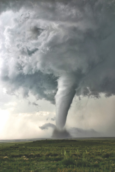
Kansas experienced an unusually quiet tornado year in 2025, reporting only 30 tornadoes, a sharp decrease compared to the 76 tornadoes documented in 2024.
The most intense tornado activity of the year occurred on May 18th, when 18 tornadoes were reported. This outbreak included all seven of the year’s strongest storms, which were rated EF3 with estimated wind speeds between 140 and 160 mph. One tornado from this event had the longest track of the year, spanning approximately 32 miles across Pratt, Stafford, and into Reno County.
The final tornadoes of 2025 were documented on September 14th in Butler County. Thankfully, no serious injuries or fatalities were reported in Kansas due to tornadoes this year.
There were 30 tornadoes in 2025, impacting 24 counties, with none in Rooks County. Kiowa County in southcentral Kansas had five tornadoes, followed by neighboring Edwards and Pratt counties, each with three. Greeley and Scott counties had 2 each, followed by 18 counties with one each.
The day with the most recorded tornadoes was May 23, 2008, with 70. This was also the most tornadoes in one episode. The decade with the most tornadoes was the 2000s, with 1,192, followed by the 1990s, with 789.
The first tornado of 2025 occurred on April 1 in Ellsworth County at 9:53 p.m., at 0.04 of a mile in length and a 20-yard width.
The last tornado of 2025 occurred on September 14 in Butler County at 4:15 p.m., measuring 0.33 of a mile in length and 10 yards in width.
The 2025 tornado season lasted 167 days (the number of days between the first and last tornadoes).
Did you know there are seven National Weather Service offices that serve portions of Kansas? They are Goodland, Dodge City, Wichita, Topeka, Hastings, Nebr., Pleasant Hill (Kansas City), Mo., and Springfield, Mo. The National Weather Service in Hastings, Neb., is the designated office for our immediate area.
Here is severe weather terminology you may encounter: Severe Thunderstorm— The National Weather Service issues severe thunderstorm warnings for storms that are currently or are capable of producing winds of 58 mph or stronger and/ or hail one inch in diameter or larger. Severe thunderstorms are often much stronger than this minimum criteria, so it is a good idea to take severe thunderstorm warnings seriously.
Tornado— A tornado is a violently rotating col- umn of air in contact with the ground, either as a pendant from a cumuliform cloud or underneath a cumuliform cloud, and it is open (but not always) visible as a funnel cloud. A funnel cloud is a condensation cloud, typically funnel-shaped and extending outward from a cumuliform cloud, and is associated with a rotating column of air that may or may not be in contact with the ground.
Flash Flood— A flash flood is flooding that occurs very rapidly and usually within six hours of heavy rainfall. Flash flooding may occur along creeks, rivers, or streams.
It can also occur in low-lying or urban areas with poor drainage. Water levels can rise very quickly during flash flooding, even in locations that did not receive heavy rainfall but are downstream from areas that did. Flash flooding can occur in the winter months when rain falls on existing snowpack, causing it to melt rapidly. Flooding is the number one severe weather killer in the U.S.
There are many good checklists available online to use as guidelines for putting a kit together. However, the basics include: a First Aid Kit, three-day supply of water/ nonperishable food (for each family member, including pets), change of clothes/shoes for each family member, prescription medicine and special needs items, a battery-powered radio, and NOAA Weather radio, cash and credit card, flashlight and extra batteries, whistle (to call for help), cell phone and charger (solar/battery powered).
Now is also a good time to sit down with your family and review your home emergency plan. Have a drill so everyone knows what to do if the warning sirens sound and where you’ll meet if you are separated during a storm.
To help Kansans practice their plan, a statewide tornado drill will be held on Wednesday, March 4, 2026, at 10:00 a.m. If severe weather is threatening on that date, the drill will be postponed.
As a reminder to all Kansans, a storm does not have to include a tornado to be dangerous.
Severe thunderstorms may include high straightline winds that can knock down trees and power lines and even buildings,” said Morgan. The possibility of large hail is another factor to consider, as is the prospect of lightning and floods.
When the weather looks threatening, we tend to go stand on the porch to see if we can spot a tornado. When severe weather is forecast, stay inside and monitor your TV, radio, or social media for weather alerts.
If severe weather is imminent on March 4, the backup date for the tornado drill will be Thursday, March 5, at 10 a.m.
